
VIP member

Garmin Jiaming Handheld eTrex 329x
Garmin Jiaming handheld eTrex 329x field collection and GIS survey expert Beidou dual star version Garmin new generation GPS+Beidou dual star receiver
Product details
Garmin Jiaming Handheld eTrex 329x
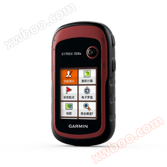
Field collection andGISInvestigation experts Beidou Double Star Version
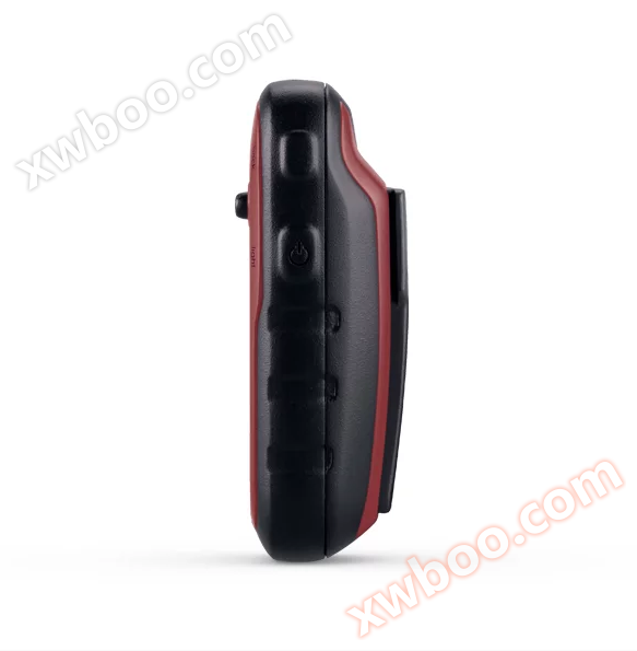
Garmin's new generation GPS+Beidou dual star receiver brings you a faster and more accurate positioning and navigation experience. Adhering to the professional, stable, and lightweight characteristics of the eTrex series handheld devices, it is sturdy, waterproof, energy-saving, and low consumption. The eTrex 329x is equipped with a three-axis electronic compass and a barometric altimeter, pre installed with detailed navigation maps covering 2840 districts and counties across the country. It supports DEM, contour lines, and custom maps, and features an anti glare color screen that is still clearly visible under strong light. It also has a five way joystick button operation design, providing you with a humanized one handed control experience during field collection operations.
Double star positioning
It can simultaneously receive both GPS and Beidou satellite systems, enhancing the reception capability and accelerating the positioning speed in areas with many obstructions.
Energy saving and low power consumption
Up to 25 hours of continuous operation time.
Large storage capacity
In addition to recording 2000 waypoints and 10000 trajectory records, trajectory records can also be wirelessly expanded according to the size of memory or storage card space, allowing you to record happily without worrying about insufficient space every day.
Multi purpose navigation measurement
Pre installed navigation electronic map and support custom map linear navigation, built-in three-axis electronic compass and barometric altimeter, positioning navigation, real-time direction, altitude, and barometric information can be obtained in one machine.
ANT+Wireless sharing
ANT+can be used to transmit information such as flight routes, waypoints, and trajectories to other compatible machines.
Multiple coordinate system formats
Capable of converting multiple coordinate systems and formats, including Beijing 54, Xi'an 80, and CGCS2000.
Area measurement
Accurate area and length measurement with real-time display, and with the ability to continue measurement and calculation even after pausing and turning off the device.
Hardware and Performance |
|
| size | 5.4×10.3×3.3 cm |
| Display Size | 2.2 inches |
| screen resolution | 240×320 |
| memory | 8G |
| Support storage cards | microSD ™ card |
| Weight (including battery) | 141.7 grams |
| Battery Specifications | 2 AA batteries |
| Battery usage time | 25 hours |
| Waterproof index | IPX7 |
| Satellite system | GPS+Beidou |
| Floatable | |
| High sensitivity receiver | |
| interface | USB |
data recording |
|
| Number of waypoints | 2000 |
| Route (x points) | 200×250 |
| Track record (points) | 9999 |
| Save track (strips x points) | 200×10000 |
map |
|
| Pre installed detailed map | |
| Support navigation maps | |
| Support contour map | |
| Support DEM elevation map | |
| Support self-made image maps | |
function |
|
| Electronic compass | three-axis |
| Barometric altimeter | |
| Track measurement area | |
| Route measurement area | |
| Calculate the average position | |
| Beijing 54, Xi'an 80 CGCS2000 | |
| Custom attribute collection | |
| wireless data transmission | |
| Buzzer sound reminder | |
| Photography function | |
| Image Viewer | |
| Photo navigation | |
| Calculate the average position | |
| Sun Moon Astronomy | |
| Support custom points of interest | |
| Compatible with tidal meters | (Need to purchase BlueChart chart) |
| Software support | Support Garmin BaseCamp Support Garmin Survey |
·ETrex 329x Host
·USB data cable
·User Manual
Online inquiry
-
Contacts
-
Company
-
Telephone
-
Email
-
WeChat
-
Verification Code
-
Message Content
-